Banks Lake Ice Climbing
January 10th, 2004
Brent, Chris Stevenson and I went over to the Banks Lake area in Eastern
Washington to see if we could find some roadside ice. The temperatures
on the East side had remained somewhat colder than the West side, so we
were hopeful. Driving in, we noticed what would prove to be our nemesis
all day long: the fog.
H202 looking good.
Agent Orange.
Zenith... not quite living up to its name.
Soon after the first climbs appeared the Coulee wall arched back away
from the road, obscuring the rest in a nefarious blanket of fog. The next
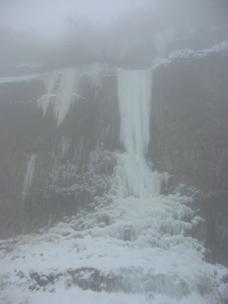
ice we saw was at the Devil's Punch Bowl. Things looked pretty in and
fat, but there were several cars parked and people all over the climbs.
However, when we took a closer look, most parties were just finishing
up, so we racked up.
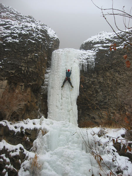
Trotsky's Folly in excellent conditions.
Trotsky's Folly, the first climb up from the road, was in great shape.
I had wanted to climb this one back in 2001, but the topout of the pillar
hadn't formed that year. As Brent was so nice to provide Chris and I with
his truck, ropes, and rack of screws, I figured I'd take the first lead.
The ice was incredible: plastic, a little soft, and steep.
Dave leading Trotsky's Folly. Photo by Brent.
Brent and Chris followed no problem, and soon we were up checking out
Trotsky's Revenge and the Punch Bowl. Trotsky's Revenge
looked almost there. The bottom steps were formed nicely, but the
final pillar was still all pencilly and wet. Judging from the only 'ok'
screws on the previous pitch, I figured that leading the upper pillar
on Revenge would have to wait for me.
Itching to lead, Chris strapped on the right side of the punch bowl.
The "death icicles" were impressively large this year, but most
of them had snapped off already. Regardless, the right side is the safest
line on it, and we climbed quickly.
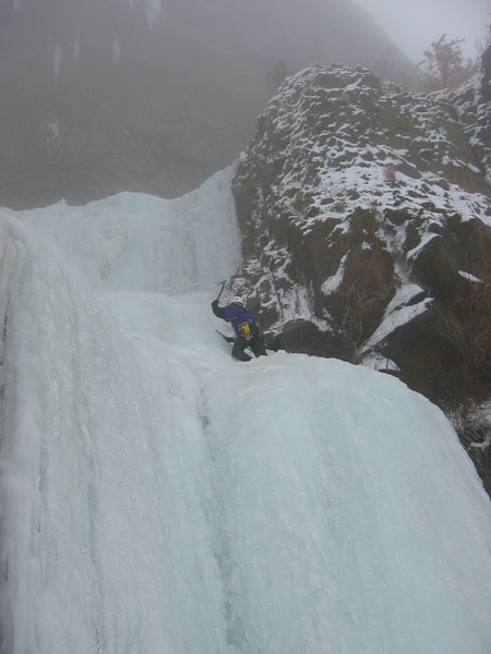
Chris leading the Devil's Punch Bowl Right.
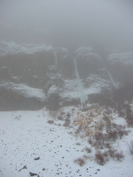
After walking off right, we headed back out to the truck. The devilish
fog had not lifted a finger, so we drove down the road to the geographically
well defined Pee Wee's Playground area. These climbs are located
directly across and south of the entrance to Steamboat Rock State Park.
No sign of the climbs yet, so we ate lunch in the rig. Brent's wife had
packed him a huge lunch of all sorts of things. Chris and I, being the
savvy alpine-light-is-right packers we are, decided that all we really
needed was a flat of Costco muffins, some cliff bars, and a bag of cashews.
The coconut-sugar-encrusted cashew variety is greatly preferred, though
those came from Brent's lunch too.
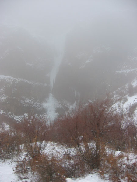
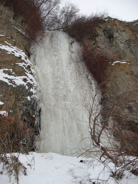
Just as we were heading out, the fog lifted enough to show us that I
was about to lead us up the wrong talus cone. Wooo, as mutiny in the fog
had been narrowly avoided, we began the incredibly demanding and physically
GRUELING 20 minute hike up the hill. Unfortunately upon closer inspection,
most climbs were either spewing water, weren't touching down, or were
too short. However, about the 5th climb from the left seemed to have very
thick and plastic ice. It was Brent's lead, and he tackled it strait on
and in great style.
The first pitch.
Brent leading.
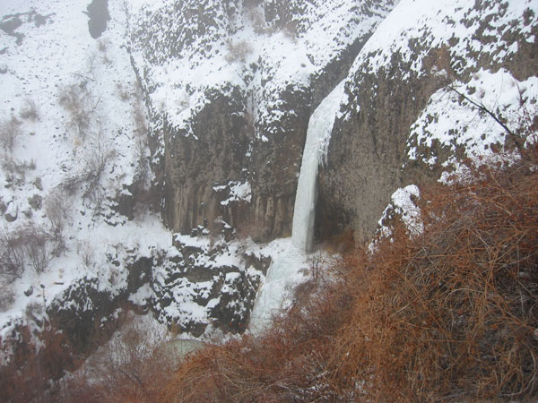
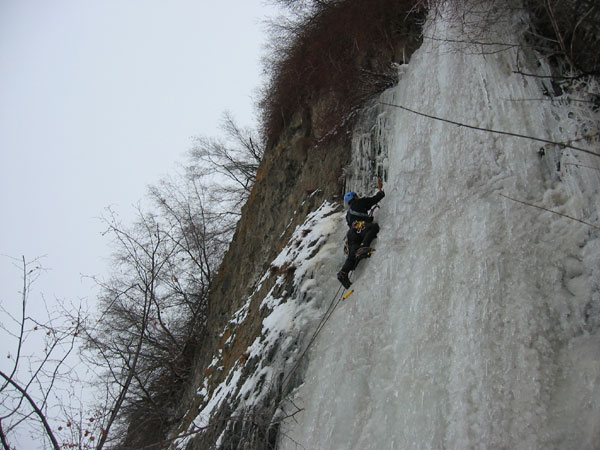
There appeared to be a few more steps up higher, so Brent brought us
up, and I set off on the next pitch. It started up about 40 feet of WI2
gully ice, then climbed a short but very steep 20ft pillar with a sketchy
picks-in-the-mud top out. That seemed like the end of the ice, but I kept
walking up, and sure enough a little ways up through the trees there was
a final little headwall/amphitheater of ice. The place looked like topout
hell, with most lines kicking back to near vertical near the top and detaching
as they met the wet rock. Hoping for more of that spectacular mud climbing,
I lead up the WI3 finish, just making the top with our 50 meter ropes.
The ice was a bit brittle but took good screws. The rope drag from "walking
through the forest" sucked though, and made the anticipated mud climbing
all the more challenging.
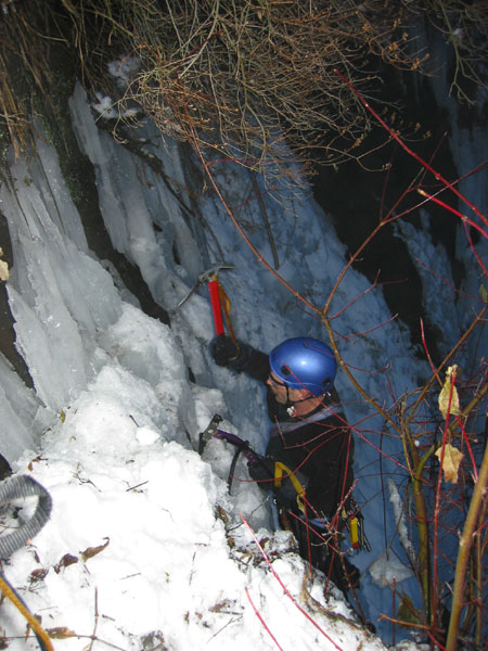
Brent gingerly hooking his way up at the top of the climb.
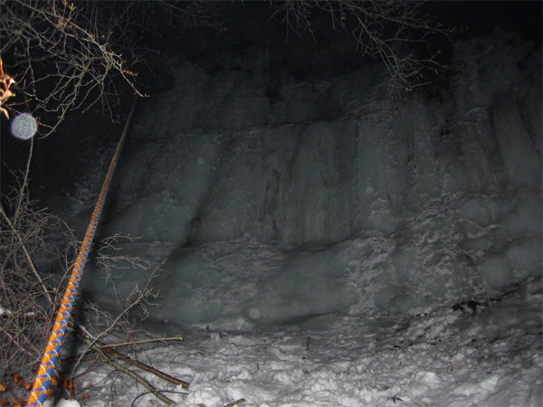
The final ice at the top of the climb on my way down. Yes astute observers,
night had indeed fallen!
The first pitch of this climb had slings on top of it, but I couldn't
find any slings in the obvious topout trees on the second pitch. My guess
is that the upper pitch of this one hadn't been climbed before, as it
is of lower quality, lower difficulty than the first pitch, and because
the upper amphitheater can't be seen from below.
A double rope rap brought us just exactly down to the top of the first
pitch, and we were lucky enough to have the ropes pull cleanly through
the forest on our first try. One more short rap down, and we were at the
packs.
After thrashing down the hill back to the car, we began the long and
fateful drive home. We took a wrong turn near Dry Falls, and ended up
driving half way to Spokane on Hw 2 before realizing our mistake. The
fog was so dense (10-20 ft visibility) that we didn't notice the mistake
until looooong after we should have. It just goes to show that fog is
evil, and Bank's Lake is the Bermuda triangle of Washington driving (for
further proof, see my last
drive to Banks Lake).
|