Mt. Slesee - Northwest Face (variation)
Slesse's Northwest Face
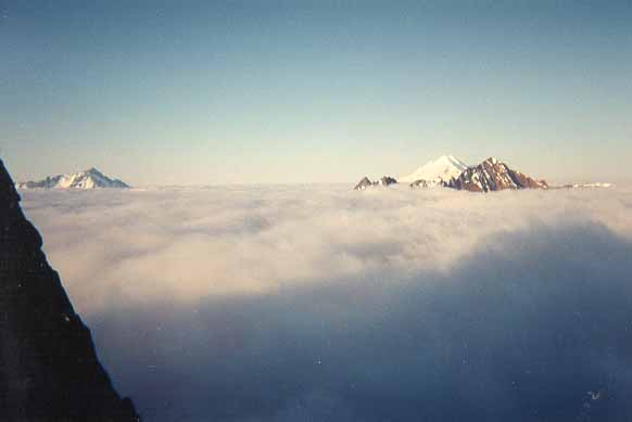
I admit, we didn't climb the normal route. Due to the amount of loose rock, perhaps a second ascent! It is difficult to see the normal line, but we took the rightmost arret and followed it strait up. This provided about 3 full hard pitches of 5.6/5.7, then two more pitches of mid-fifth to the summit. The rock was generally steep, carefully protectable, and extremely loose. Care must be taken when placing belays for massive rockfall! The route follows the arret up cracks and gullies for three pitches, then works leftward two more pitches until the summit is reached. Overal a spectacular climb on steep rock in a beautiful remote alpine setting.
The route is easy to get to, just find the big notch and climb the exposed, unprotectable class 3/4 gullies to the base of the route. The desccent is not trivial, and should be done with plenty of daylight. Downclimb south towards the southwest route and make a double rope rappell down to slabs, or two singles down. Climb down gully until drop off, and find path northward across exposed forth class ledge system. This leads back to the base of the route.
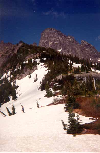
A beautiful morning on the wall
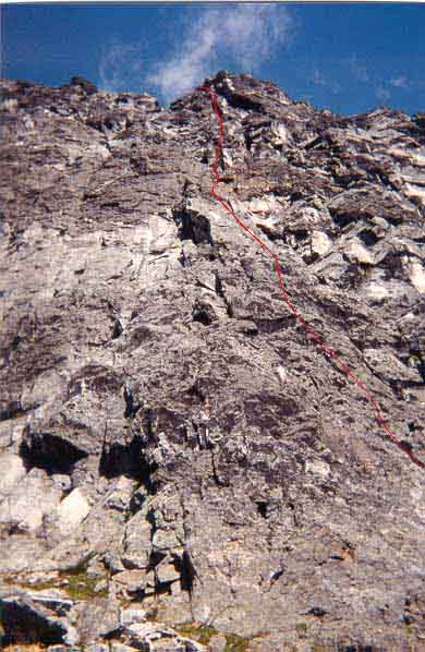
Our route in red
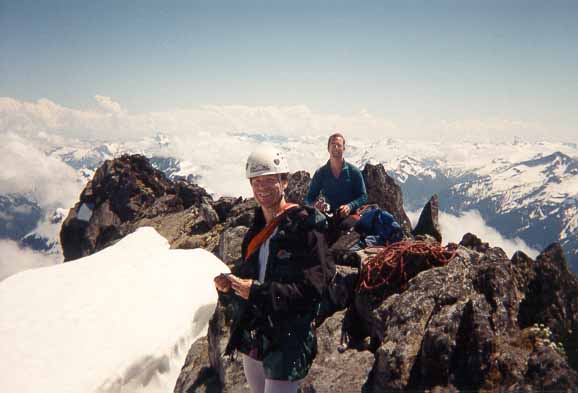
The summit!
Driving directions to the trailhead:
This was extracted from the BOEALPS Conditions page.
8/15/98
Only water is from small snow patch 6700ft in basin below NW face. Current road access: From the sharp E turn at the near side of the Chilliwack river bridge go 13.2 mi. to hilltop E of Slesse creek on Chilliwack Lake road. This turn is further E than the gravel pit. Follow Slesse creek S but do not cross bridge to W side of creek at any time. We never found a "11 km" painted on a rock frequently mentioned in references. Ignore all surveyors tape. At the intersection for the bridge spur, there a 2 foot square orange sign on a tree between the road branches, pointing left "New Slesse Creek trail 5 km." Continue S on logging road avoiding branches. The road is rough and a high clearance vehicle is recommended. Follow road as far a you can-there is no clear end. We parked short distance before a large, 2 ft. diameter log, and bolder lined, but not designated in any way, parking area. It is possible to continue the equivalent of 10 minutes hiking time by driving between a rock and a log on the left side of the parking area. It maybe difficult to turn around if you drive beyond the parking area. There is no clear transition from road to trail. Someone has turned the logging road into a fine trail. Hike 30-40 minutes from parking area to Slesse Mountain Trail branch. The logging road/trail continues S beyond this branch through the large creek drainage and clear cut. The mountain trail is marked with a 2 foot square orange sign "Slesse (creek or mountain?-I don't remember) Trail located in a tree a little up the hill from the road. There ismemorial plaque also located on the E side. The trailhead is S of the confluence of several longmajor streams from the mammoth basin of peak on the other (W) side of the valley but N of the Sedge of an old clear cut on a treed shoulder of the same peak.
- Doug Sanders